KampTrail

Public beta · Free · No account required

Find camping, parking and RV services.

Check land management, save your stops and plan your trip.

Use in your browser. Install on your phone or computer when you’re ready.Úsalo en tu navegador. Instálalo en tu teléfono o computadora cuando quieras.Utilisez-le dans votre navigateur. Installez-le sur votre téléphone ou ordinateur quand vous le souhaitez.

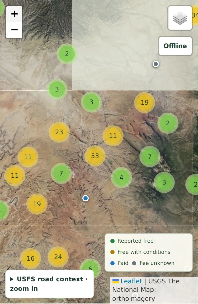
KampTrail map preview near Moab, Utah
© OpenStreetMap · USGS

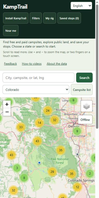
Choose a state or search to start.

Scroll to read more. Use + and − to zoom the map, or two fingers on a touch screen.

How it works

A LITTLE PLANNING. MORE TIME OUTSIDE.

From first look to ready to roll

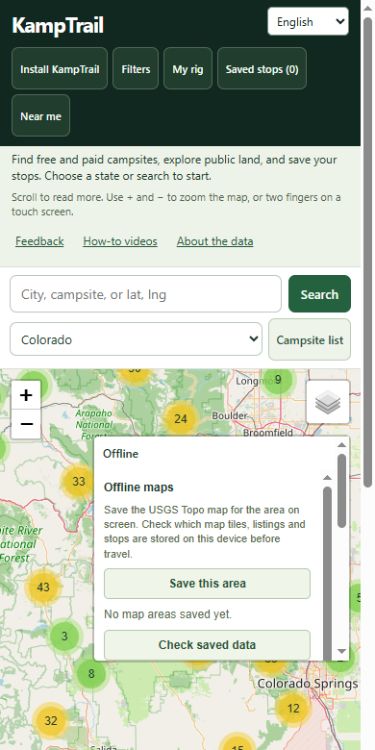
KampTrail Offline panel for saving Topo map areas
03

Prepare before you go

While connected, save your stops and use Offline to download Topo map areas. Check your saved content before losing service.

Map images: © OpenStreetMap contributors

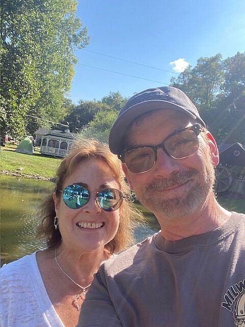
Chuck and Cindy Price of Boondock or Bust
Chuck and Cindy Price · Boondock or Bust

THE CAMPER BEHIND KAMPTRAIL

Built by Chuck from Boondock or Bust

I’m Chuck Price, a lifelong camper and the creator of Boondock or Bust. Cindy and I travel in a 2018 Hymer Aktiv Class B after years with a Class C Gulfstream.

I’m building KampTrail to bring campsite information, public-land context, and trip planning together. Start with a place you know and tell me what would make it more useful for your trips.

Meet Chuck and Cindy on Boondock or Bust

TAKE KAMPTRAIL WITH YOU

One tap closer to your next stop

Add KampTrail to your home screen or app launcher for easy access. Free, with no account required.

Installation does not download maps. While online, use Offline to save Topo maps and save your stops. New routes, fresh weather and sending feedback need a connection.

iPhone and iPad

In Safari, open Share (or the page menu, then Share). Choose Add to Home Screen and tap Add. Look under View More if needed. Leave Open as Web App on if offered. If these options are missing in your browser, open this page in Safari.

Android

In Chrome, open the three-dot menu, then Install and create shortcut, then Install. Some versions show Add to Home screen or Install app. Follow the prompts.

Windows and other computers

In Chrome, use the address-bar Install icon, or the menu: Cast, save, and share, then Install page as app. In Edge: More tools, Apps, then Install this site as an app. If unavailable, bookmark KampTrail.

Mac with Safari

In Safari on macOS 14 or later, choose File, then Add to Dock. Chrome and Edge also offer installation.

Before your first trip with KampTrail

Is KampTrail free?

The current beta is free to use. No account is required to explore the map, save stops, or send feedback.

Do I need to install an app?

You can use KampTrail in your browser. Install KampTrail explains how to add it to your home screen or app launcher.

Where are my saved stops stored?

Saved stops stay in this browser on this device. Export a GPX file to back up your trip or move its stops to another device. Clearing site data removes local saves.

What works without a connection?

Prepare while online. Previously viewed listings and saved stops can remain available when browser storage permits. Use Offline to save selected USGS Topo map areas. New routes, fresh weather, land lookups, and sending feedback need a connection.

Are campsite details verified?

Listings combine agency records, OpenStreetMap data, and moderated visitor contributions. Coverage and dates vary. Unknown fees stay unknown. Confirm current fees, access, closures, and vehicle suitability with the operator or land manager.

Will routes account for my RV dimensions?

Current routes use car routing. Your rig profile and mapped clearance candidates do not establish a safe or legal route for your vehicle. Check restrictions, road conditions, and posted signs before traveling.

Help improve KampTrail

Found a bug or have an idea? Send it privately. No account required. Email is optional.

Feedback is reviewed privately. A suggestion is not a promise to build it. For a campsite correction, use “Suggest a fix” on that listing.

About the data

Loading catalogue information…

Sources and dates

Campsite records come from Recreation.gov, the US Forest Service, the Bureau of Land Management, and OpenStreetMap contributors. City search uses GeoNames. Each listing links to its source when available. Forest Service and BLM listings retain the full camping-fee wording and source field when supplied. Use Fee evidence to inspect source records and retrieval dates. A source update date is shown only when the feed provides one.

Loading data freshness…

Campsite refresh dates describe source downloads. Expanded service freshness uses each saved extract’s source date; individual service points also show retrieval dates. These dates do not mean a location was recently checked. Listings have not been field verified.

Coverage and fees

Coverage varies by state and is incomplete. A missing campsite does not mean camping is prohibited. A public land location does not establish permission to camp.

“Reported free” means the source says camping has no fee. Free water, showers, parking, or day use do not count. “Free with conditions” means camping is free only in some seasons, for some sites, or with a pass or permit. “Fee unknown” means no reliable camping fee was supplied. It does not mean free. Being reservable on Recreation.gov, or a note to check Recreation.gov, is not treated as fee evidence. Confirm fees, access, seasonal closures, and reservations with the operator.

Some Forest Service camping opportunities are secondary activities rather than the main map category. KampTrail includes them only with evidence of on-site camping. Administrative offices, trail access alone and broad multi-area pointers are excluded. Agency points are checked against Census state boundaries; ambiguous or invalid locations are held for review rather than assigned to the nearest town.

Camping care checklist

Current local orders and posted rules control. General guidance remains readable offline in a saved app; source pages need a connection.

Guidance: BLM camping · USFS camping · Leave No Trace. Sources checked . General guidance, not a current site inspection.

Public land, weather, and services

The public land layer and land manager lookup use the BLM Surface Management Agency map. Boundaries can be approximate and do not grant permission to camp. Posted signs and local orders take priority.

Fire perimeters come from NIFC; satellite smoke plume polygons come from NOAA HMS. Layers load only when enabled and zoomed in. Each feature shows its source date and retrieval time. Smoke plumes do not measure ground-level air quality or AQI. Perimeters are incomplete and are not evacuation boundaries or closures. Weather alerts are checked on demand at a coordinate using the National Weather Service. This is not an emergency notification service. Dynamic fire, smoke and alert data require a connection and are hidden offline. Check local authorities, land-manager restrictions and posted signs before travel.

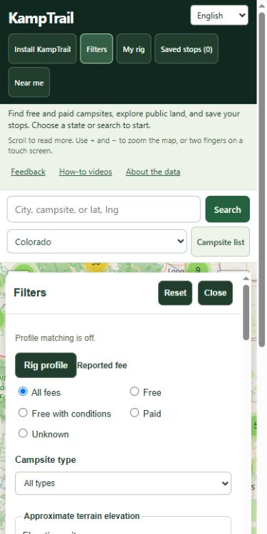
Approximate terrain elevation filters use dated USGS 3DEP interpolated samples at catalogue coordinates. Their retrieval date is not a terrain acquisition date, and grid resolution does not guarantee point accuracy. Missing or coordinate-mismatched samples stay unknown and do not satisfy elevation bounds. Elevation does not establish road grade, clearance or RV suitability. Validated state samples can remain available offline with their source date.

Forecast filters use published NOAA/NWS NDFD temperature samples over the next 24 or 48 hours. Bounds apply to every published sample, at the displayed cadence of up to three hours; they are not continuous or daily temperature extremes. The NDFD file modification time is not each location’s forecast issuance. Missing, incomplete, expired and offline samples are excluded. Weather stays separate from saved terrain evidence.

On-demand forecasts and the separate forecast-grid elevation display come from the National Weather Service and cover US locations only. These are separate from the campsite terrain samples. Topo and satellite basemaps come from the USGS National Map.

Service discovery uses OpenStreetMap tags for dump stations, water fill points, LPG, showers, laundry, groceries and fuel. Expanded coverage and source extract dates appear in Sources and dates above; an incomplete refresh keeps the previous saved coverage. Areas without an expanded extract retain older dump, water and LPG records. Each point shows source dates and access evidence. Opening, RV access, cylinder refills and overnight permission are unverified. No loaded matches may reflect incomplete coverage. Visited, validated service areas can be read offline with source dates; uncached areas stay unknown.

The optional official rest-area layer begins with TxDOT's Texas location list. Travel information centers are excluded from this pilot. Each point links to its source and download date. The separately sourced 24-hour visitor stay limit is duration context, not permission to sleep overnight. Current opening, available spaces and overnight permission remain unknown. Other states have no coverage in this layer yet. Saved rest-area stops retain dated source context; reconnect to check current permission.

The optional clearance-candidate layer shows OpenStreetMap objects that carry a height tag, nationwide, from zoom 10. Only plain numeric tags are compared with the travel height in your rig profile; a clearance equal to your rig height is a conflict, never clear. Suspect, conditional, direction-specific, mixed and unknown values stay visible as needing checking. Along a calculated route a candidate counts as on the driven road only with an exact OSM identity match; nearby candidates stay unresolved, and segments without data are listed. Rhode Island uses its dated pilot file, shown as raw tags and never compared, until it joins the national set. Moderated visitor reports of posted clearances appear separately. Nothing here establishes passage, legal access or that unmapped hazards are absent. OpenStreetMap data: ODbL 1.0.

RV site lengths, hookups, stay limits, and some fees come from Recreation.gov campsite records. A match means one campsite reports your length and every hookup you chose. Different sites in the same campground are never combined. Road routes, drive times and requested detour estimates use the FOSSGIS OSRM car router. They are not checked for RV height, weight, length or current road conditions. Along-route discovery searches near the road geometry and applies the same reported-data filters as the map. Approximate distance from the line is separate from a driving detour.

Offline maps save USGS Topo tiles for an area you choose. The standard map is not saved, because OpenStreetMap's tile policy does not allow bulk downloads.

Corrections

Use “Suggest a fix” on any campsite, or long-press the map and choose “Suggest a campsite here.” No account is needed. A moderator reviews every report before the map data changes. This device keeps a private link to each report so you can check its status.

USFS road designations

The optional USFS motor vehicle roads layer uses the Forest Service MVUM map service. Zoom in and select a road for vehicle and seasonal fields. District coverage is incomplete and unit dates vary. A designation does not establish camping permission, current conditions, clearance, or RV passability. Consult official district maps, closures and posted signs. Recently viewed road data can remain available offline for the same view, labeled with its retrieval date. Topo map saving remains separate.

Camper reviews and photos

Open “Reviews and photos” on a campsite to read firsthand experiences or contribute your own. Every review and photo needs moderator approval. Visit dates and rig details provide context. Optional dated reports cover approach, noise, shade, crowding, personal comfort and carrier signal. Published community ratings and same-visit observations can filter map and route results. Missing reports stay unknown. Evidence saved on this device can be used offline for up to seven days, labeled with its last check. Observations can become outdated and do not establish current fees, access, safety or camping permission. Carrier observations are not FCC coverage predictions.

Your public name, review, visit date, rig details and approved photos are public. Photo files are resized and metadata is removed. Submissions and photos are stored in KampTrail’s database hosted by Hostinger. Moderators can inspect pending content. Rate limiting uses a salted hash of your connection address. No account or email is required. Keep your private management code to edit or delete a review on another device. Clearing browser data removes the saved code. Reviews and photos require an internet connection.

Attached videos are external YouTube links. The video ID is stored with your review. The whole review and video need moderation. Saving edits removes them from public view until reviewed again. Play checks publication, then loads a third-party YouTube player. YouTube may show ads and collect information. Video dates are unknown, and outside content may change.

Routing privacy and offline routes

Calculating a route sends stop coordinates to FOSSGIS through KampTrail. KampTrail does not store coordinates or route geometry in its server database. It keeps a salted connection hash for routing limits. FOSSGIS may log routing requests under its own policy. Successful routes are cached on this device when browser storage allows. Saved routes can be reused offline, with their calculation date displayed. New routes and driving detours require a connection.

Your rig profile

“My rig” keeps one named profile in this browser. Dimensions, campsite preferences and JSON import/export stay on your device and are not sent to KampTrail or the routing provider. Export the profile to back it up or move it to another device. Imports show a preview before you choose to replace your profile. When device storage fails, you can explicitly use a profile for this session and export it.

Campsite fit length is separate from your full travel combination length. Applying a saved profile updates the matching campsite filters; editing those filters or resetting filters turns the profile link off while retaining the profile. Travel height, width, combination length and weight are reference values. They do not make car routing enforce vehicle restrictions. Unknown source measurements do not verify a fit. Clearing browser data removes the saved profile.

Terrain along your route

After calculating a car route, open its terrain profile and choose “Load terrain profile” to request USGS 3DEP samples. This sends up to 200 sampled coordinates to USGS through KampTrail in bounded requests. It does not send the full route, stop names, notes or rig dimensions. The server keeps a bounded cache of independent terrain values under coordinate hashes, plus request counters; it does not store the route or rig profile. USGS receives the requested sample coordinates.

Samples describe ground terrain, including under a bridge or above a tunnel. They do not measure the road surface, road grade, cumulative ascent, clearance or safe passage. The profile shows source and retrieval dates, available datum metadata, sample spacing and unknown gaps. It includes route endpoints and leg boundaries; longer routes have wider sample spacing. Minimum and maximum values describe only the samples.

Up to eight exact-route terrain profiles can stay on this device when storage allows, without automatic expiry. Offline views show their original dates and gaps; changed routes require their own profile. Choose refresh or retry to request new samples online. “Clear saved terrain” removes the stored profiles; an already open view remains visible until you close it. Clearing browser data also removes saved terrain.

Saved stops and offline use

Overnight permission is separate from price, parking and reviews. Open “Overnight permission” for dated, place-specific official evidence and moderated firsthand reports. A personal grant or a stay without asking does not establish permission for other visitors. Initial official evidence covers two BLM locations; other places remain unknown. The report location, visit date, public name and text become public only after approval. Private management codes stay on this device; reports and permission conclusions are not saved offline.

Saved stops, notes, and dates stay in this browser on this device. Export a GPX file to back them up or move them to another device. After an online visit, listings for areas you viewed stay available offline. Map imagery needs internet, except Topo areas you saved with Offline. Campsite name search works offline after one online search. Directions, forecasts, and land lookups need internet. Clearing browser data removes saved stops and saved maps.

Embedded and full-page versions may keep separate saved stops, depending on your browser. No account is required. Standard map tiles are requested from OpenStreetMap. Topo and satellite tiles come from the USGS.

Moved from the old address

KampTrail moved to kamptrail.com. Saved stops and offline maps belong to the address where you saved them. On the old address, open Saved stops and choose Export GPX. Here, choose Import GPX. Save offline map areas again on this address before you travel.

Optional analytics settings

Privacy details. Optional beta measurement starts only after you allow it.